DHHL Hawai‘i Island Plan Update

DHHL Hawai‘i Island Plan Update
The Department of Hawaiian Home Lands (DHHL) is developing an update for the 2002 Hawai‘i Island Plan.
The Island Plans are island-specific, 20-year visioning documents that designate land uses for Hawaiian home lands and serve as a guiding framework for DHHL’s activities and initiatives related to the allocation, utilization, and stewardship of Hawaiian Home Lands. The Island Plans establish land use goals and objectives based on the General Plan, develop land use designations to meet the needs of DHHL, ensure proper stewardship of the ‘āina and identify needs and opportunities of DHHL beneficiaries through community consultations, and workshops with the Hawaiian Homes Commission (HHC).
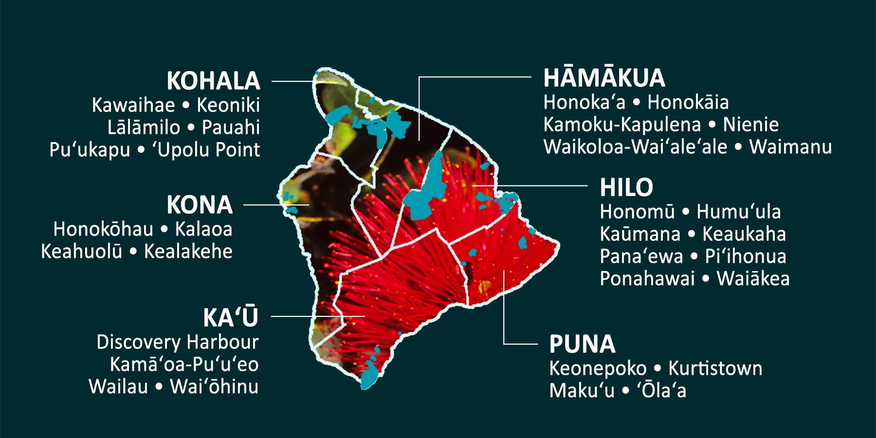
The purpose of the Hawai‘i Island Plan Update is to update the overarching guidance and recommendations for appropriate land uses at the regional level for the over 117,000 acres of land on the mokupuni of Hawai‘i. The Hawai‘i Island Plan Update will also examine infrastructure needs and opportunities from an island wide perspective, gauge beneficiary wants and needs, and identify priority areas for homestead development, community use, and income generation, including incorporating the new DHHL land use designations identified in the 2022 General Plan Update.
UPCOMING BENEFICIARY CONSULTATION MEETINGS:
The Third and Final Round of beneficiary consultation on DHHL’s update to the Hawai‘i Island Plan is scheduled for December 2025. DHHL beneficiaries are asked to participate in the update to this plan to comment on both preferred land use designations for DHHL lands on the island and to identify priority homesteading areas for development.
A series of four in-person meetings will be conducted during the first week of December to present on the updates to Draft Plan. As the land inventory for Hawai‘i Island is nearly 120,000 acres, these meetings will not present on all of the DHHL lands on the Island, rather the meetings will discuss the lands in the vicinity of the moku. Meeting materials and presentations will be posted ONLINE HERE for those who are unable to attend the in-person meetings for review. A COMMENT PERIOD will be opened following the in-person meeting series and beneficiaries will be able to view all the updated maps and materials and provide comments through the comment period.
MEETING SERIES SCHEDULE, for lands in:
- Kaʻū Moku: Monday, December 1, 6-8 PM at Nāʻālehu Community Center
- Hilo & Puna Moku: Tuesday, December 2, 6-8 PM at Keaukaha Elementary School
- Kona Moku: Wednesday, December 3, 6-8 PM at West Hawaiʻi Civic Center, Community Meeting Hall
- Kohala & Hāmākua Moku: Thursday, December 4, from 6-8 PM at DHHL West Hawaiʻi District Office, Kūhiō Hall
*All meetings will include summaries and tract maps for the ‘Āina Mauna Legacy lands in Humu‘ula and Upper Pi‘ihonua.
Round 2 Maps:
- Hilo-Puna Moku Tract Maps – Round Two
- Kaʻū Moku Tract Maps – Round Two
- Kona Moku Tract Maps – Round Two
- Kohala & Hāmākua Moku Tract Maps – Round Two
For questions or more information, contact Lillie Makaila with DHHL’s Planning Office at [email protected] or (808) 730-0346.
Meeting Notes From Round One:
Meeting Notes From Round Two:
REFERENCE MATERIALS
- DHHL Hawaii Island Plan 2002
- DHHL West Hawaii Island Plan Update 2009
- Postcard Mailing (Round Two)
- Postcard Mailing (Round One)
- HILO MOKU TRACT MAPS – 2002 VERSION
- PUNA MOKU TRACT MAPS – 2002 VERSION
- KA‘Ū MOKU TRACT MAPS – 2002 VERSION
- KONA MOKU TRACT MAPS – 2009 VERSION
- KOHALA MOKU TRACT MAPS – 2002 VERSION
- HĀMĀKUA MOKU TRACT MAPS – 2002 VERSION
- ‘ĀINA MAUNA LEGACY TRACT MAPS – 2002 VERSION
