
Nānākuli Ranch Aerial Drone Survey Project
DRONE OVERFLIGHT SURVEY – NOTICE OVERFLIGHT
SCHEDULED FOR: MARCH 25, 2026 @ 9 a.m. (Weather Permitting)
PURPOSE: DOCUMENT EXISTING CONDITIONS FOR EMERGENCY PREPAREDNESS
This is a notification that the Department of Hawaiian Home Lands (DHHL) will be conducting a drone overflight of the general project area on Wednesday, March 25 at 9 a.m. – weather permitting – to document existing project conditions and topography.
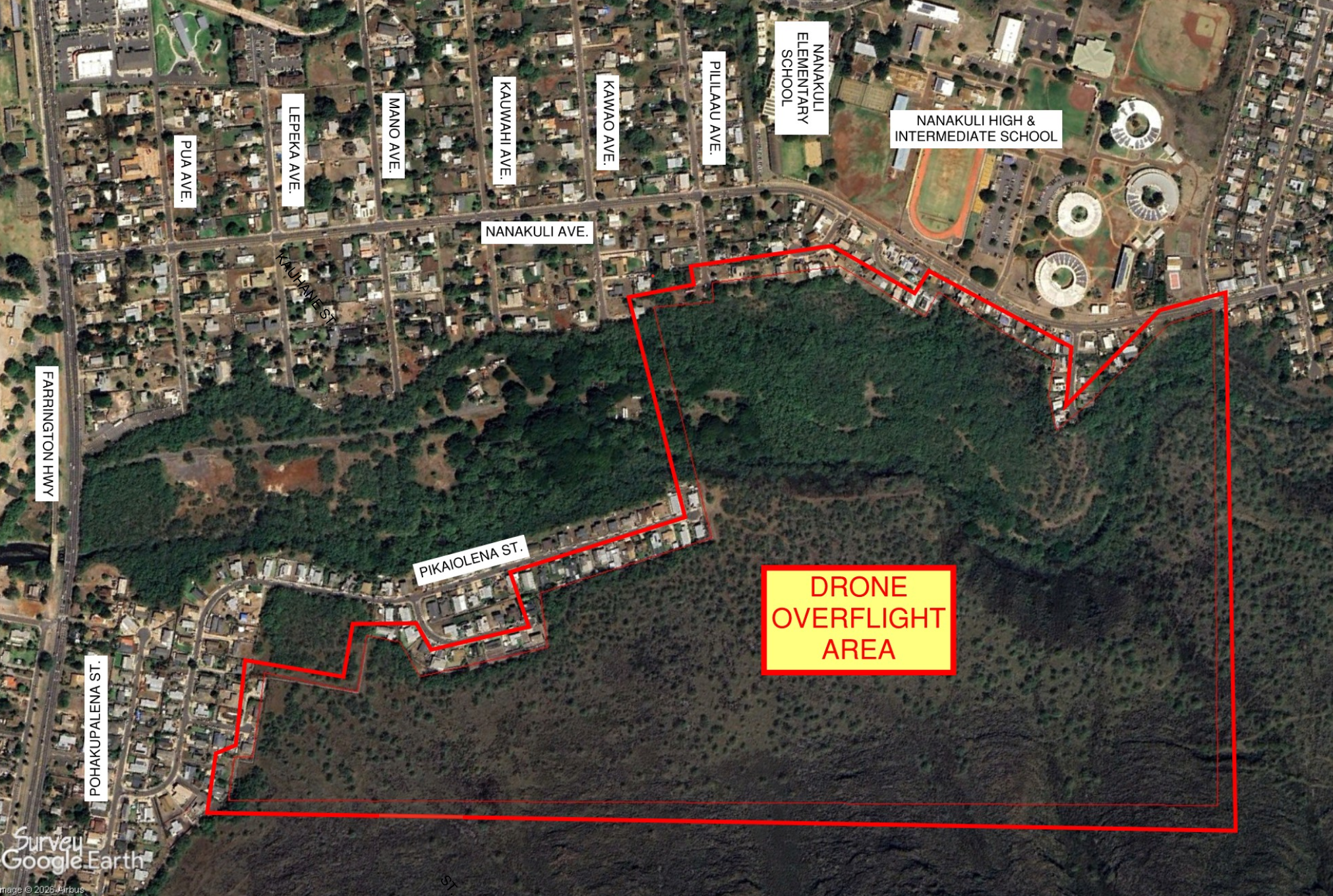
The above map illustrates the anticipated flight area of the drone. This aerial is part of DHHL’s on-going effort to maintain accurate and up-to-date records of its lands to support future emergency preparedness and planning activities.
All images collected during the aerial reconnaissance will be processed and securely stored solely by DHHL for use on this project. DHHL and ATA will comply with all applicable Federal Aviation Administration (FAA) and State of Hawai’i requirements during the drone overflight. Effort will also be made to avoid capturing images of individuals.
For any questions regarding the drone overflight survey, please contact Bladimir Gonzalez, project manager for DHHL at 808-282-2988.
State of Hawai’i:
Department of Hawaiian Home Lands
Phone: 808-730-0327
General Contractor:
Austin Tsutsumi & Associates, Inc.