
Maui Detention Basins Aerial Drone Survey
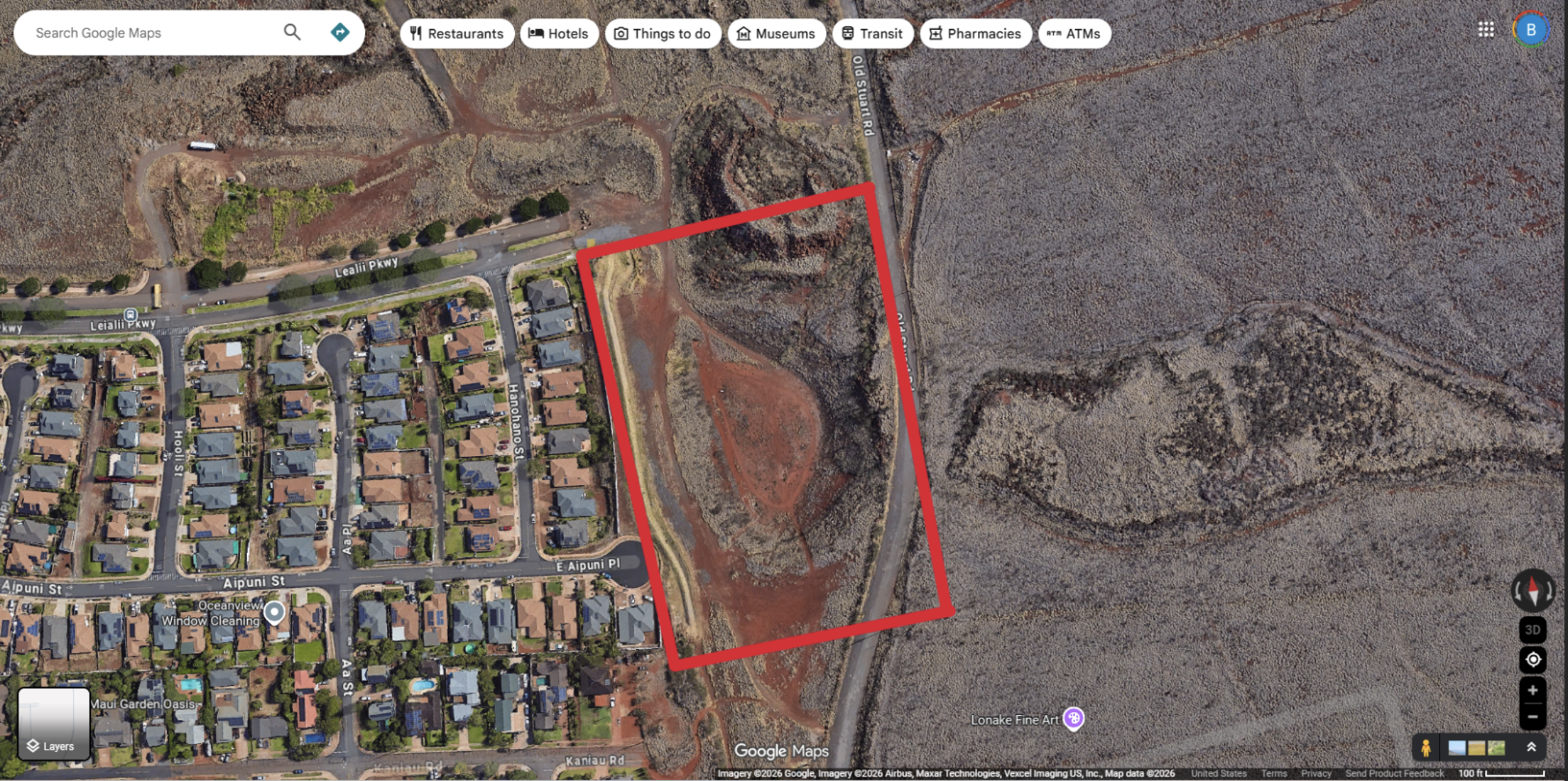
Figure 1 Proposed Aerial Drone Survey over Leialiʻi Detention Basin
DRONE OVERFLIGHT SURVEY – NOTICE OVERFLIGHT
SCHEDULED FOR: MARCH 31, 2026 @ 9 A.M. (WEATHER PERMITTING)
PURPOSE: DOCUMENT CONDITIONS POST KONA LOW STORM EVENTS
This is to notify area residents that the Department of Hawaiian Homelands (DHHL) will conduct a drone overflight of the detention basins highlighted above and in over the Leialiʻi and Waiohuli area on March 31, 2026, weather permitting.
The purpose of this flight is to document current basin conditions following the recent Kona Low storm events.
The highlighted area indicates the planned flight path. This aerial survey will help DHHL document and verify storm effects for presentation to state and federal agencies as part of ongoing storm‑relief project efforts.
All images collected during the flight will be processed and securely stored by DHHL for use on this project. DHHL will comply with all applicable Federal Aviation Administration (FAA) and State of Hawaiʻi requirements. Efforts will also be made to avoid capturing images of individuals.
For any questions regarding the Drone Overflight Survey, please contact: Bladimir Gonzalez, DHHL project manager at (808) 282-2988.
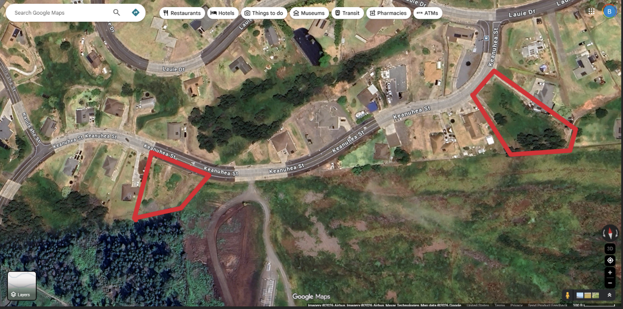
Figure 2 Proposed Aerial Drone Survey over Waiohuli Hikina Detention Basins
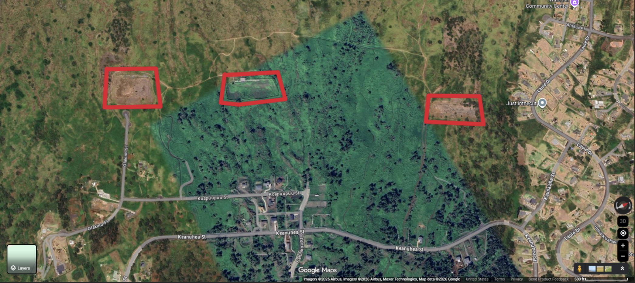
Figure 3 Proposed Aerial Drone Survey over Waiohuli Detention Basins